Plan the Ultimate Road Trip with This Map of Nationalized Pangaea
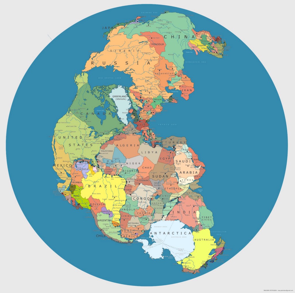
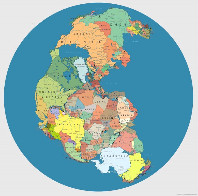
Artist Massimo Pietrobon has drawn Pangaea with contemporary political boundaries and it’s pretty awesome. Think of the road trips you could take on the ur-kontinent! I’m imagining a cool circular loop of Antarctica -> Australia -> Tibet -> India, or maybe New England -> Morocco -> Spain -> Greenland. There are some adjacencies that could prove geopolitically troubling, like Florida is too close to Liberia for either entity’s comfort, but this is a fun game nonetheless.
[via Fast Company]